Русский


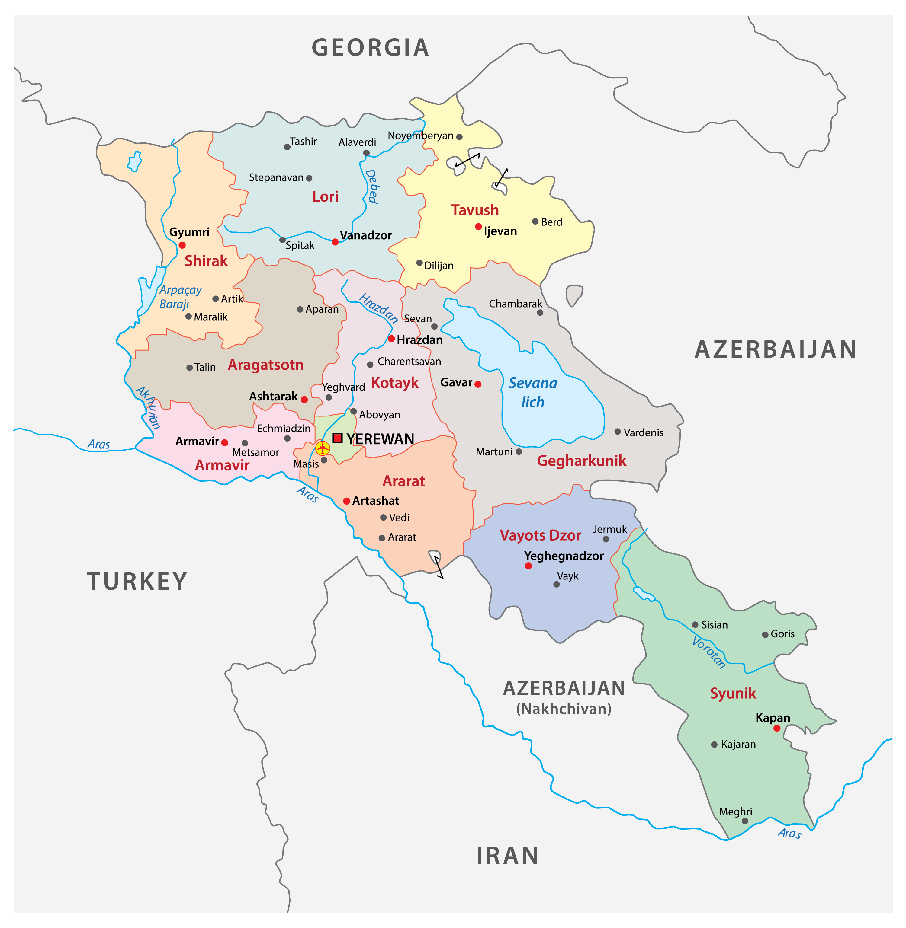
Armenia is a landlocked country in the Transcaucasia region, between the Black and Caspian Seas, that lies at the crossroads of Europe and Asia. The location of Armenia is a reason for the unique landscapes and the development of unique culture and traditions throughout thousands of years. Mountain valleys, extinct volcanoes, forests and rapid rivers make for a magnificent scenery. It’s to no surprise that in Ancient Armenia people once worshipped the nature itself as the landscapes and wildlife of Armenia are hard to forget.
The country encompases the best of Europe and Asia, combining the two into a mix of unforgettable experiences.
To the North the country neighbors with Georgia, to the North-East and the South-West with Azerbaijan, to the East with the Republic of Artsakh (unrecognized state), to the West with Turkey, and to the South with Iran.
The highest point in Armenia is the Aragats mountain that is located 4,090 metres above the sea level. Aragats is also the highest point of the Lesser Caucasus. The longest river in Armenia is the river Araks, the length of which in the territory of Armenia is 158 km. However, the full length of the river is 1,072 km as it flows through Turkey, Armenia, Azerbaijan and Iran. The lowest point of Armenia is the gorge of the Debed river which lies 380m above sea level. The largest body of water in Armenia is the Lake Sevan which also happens to be one of the largest high-attitude freshwater lakes throughout all of Eurasia.